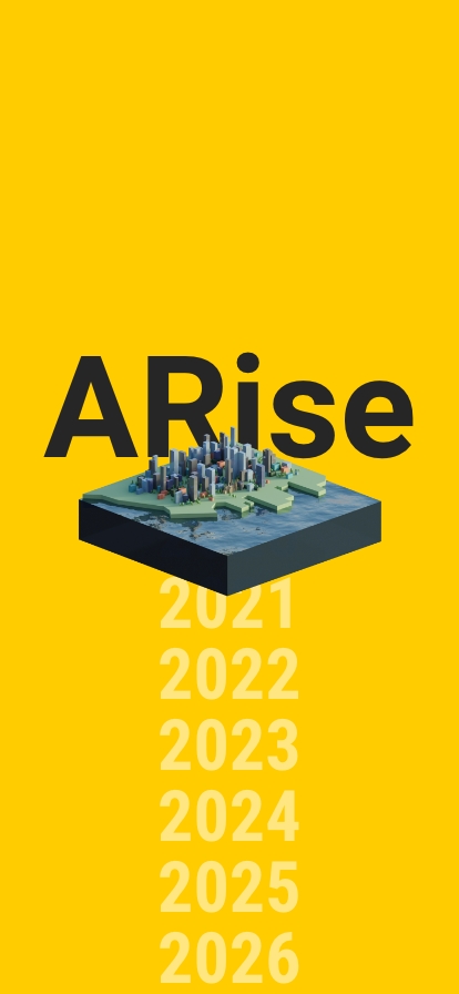
ARise (RISE)1
A concept to materialize the future of climate change
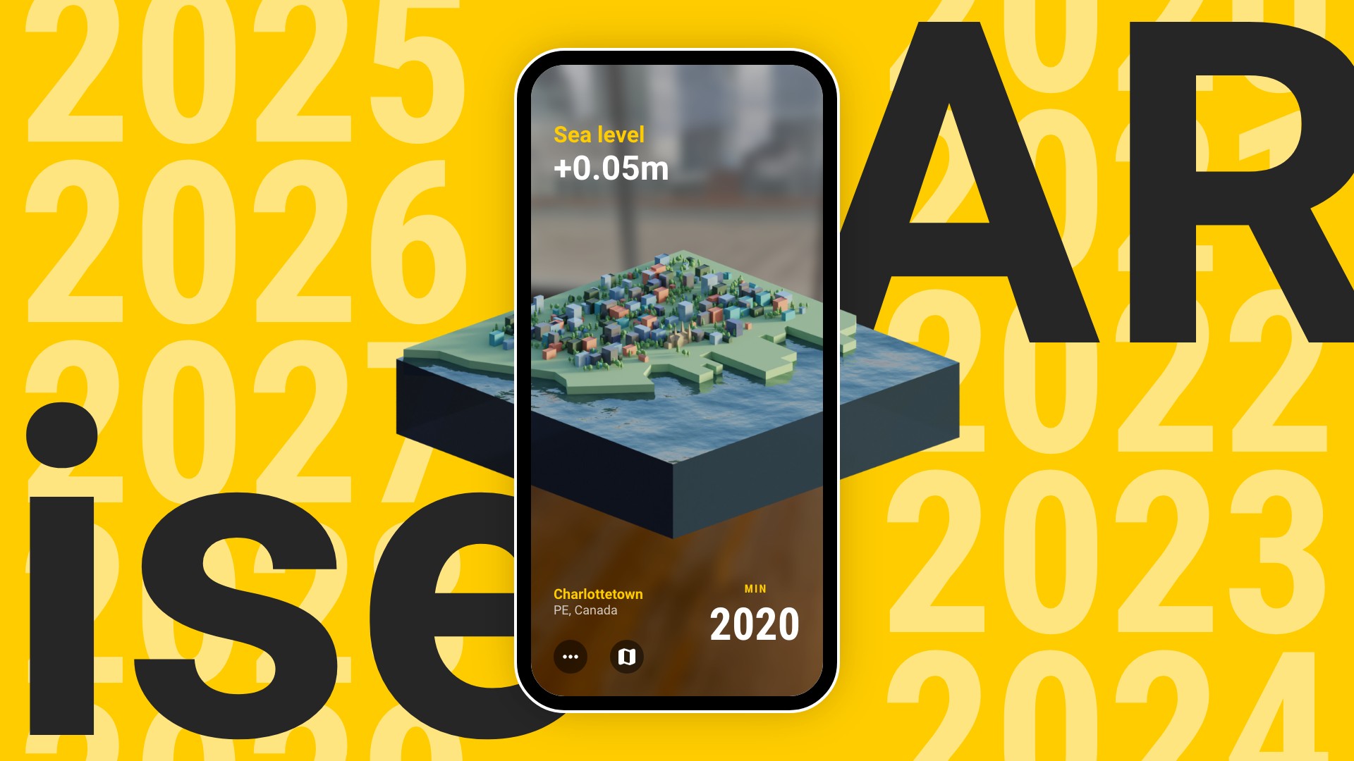
ARise (RISE) is an augmented reality (AR) mobile app concept. It will render the nearest coastal city to the user with their location data in a diorama with a simulated sea level based on projected and scientific data fromNASA.
In the creation of ARise, we are investigating the climate crisis by examining the rising sea levels and using the medium of 3D production and AR to visualize our exploration. This app would be created as an educational tool as well as an immersive experience in order to create an emotional connection for the user and to raise awareness of the climate crisis.
Role
UI/UX Designer
This project was a collaboration with Tessa Hudson at Concordia University2 in 2021.
Questions
1. How can we materialize a future scenario that will reflect the impact of climate change?
2. And how can the way that we materialize a speculative future impact the relationship the audience has with their current environment?
Ideation
The climate crisis concerns both of us. Since the application of AR has a significant influence on the teaching and learning process3, we considered the impactful influence it has on provoking discussions and criticizing by speculating the possible future.
One of the primary inspirations for ARise is Mel Chin'sUnmoored(2018), an AR mobile application experience available in Times Square that allowed pedestrians to see the surrounding area as it would appear once sea levels have risen, flooding the city.
Proposal
Throughout the creation of this project, we will be using a heuristic cyclical development process in order to refine the actual object as well as our research question.
Method
Our method is one that attempts to provoke the viewer into experiencing an emotional and personal reaction by portraying the world through a new lens.
The project is virtual and yet utilizes real space, while simultaneously processing real-time altitude and location data. As such we create an experimental space where the virtual and non-virtual meet, the speculative crossing into a space which the user usually experiences as a source of media and information, changing their relationship with the artwork.
Enthics
This project will be using environmental projections from a dataset.
Since we are taking data from an external source, it is important to disclose that climate models are simplified in order to make predictions, as they do not show the full variety of the impact of the climate crisis.
We also want to acknowledge that we are coming from a place of privilege.
The discipline of computation arts assumes that those who are experiencing this art need a digital device, which is not something that is accessible to everyone.
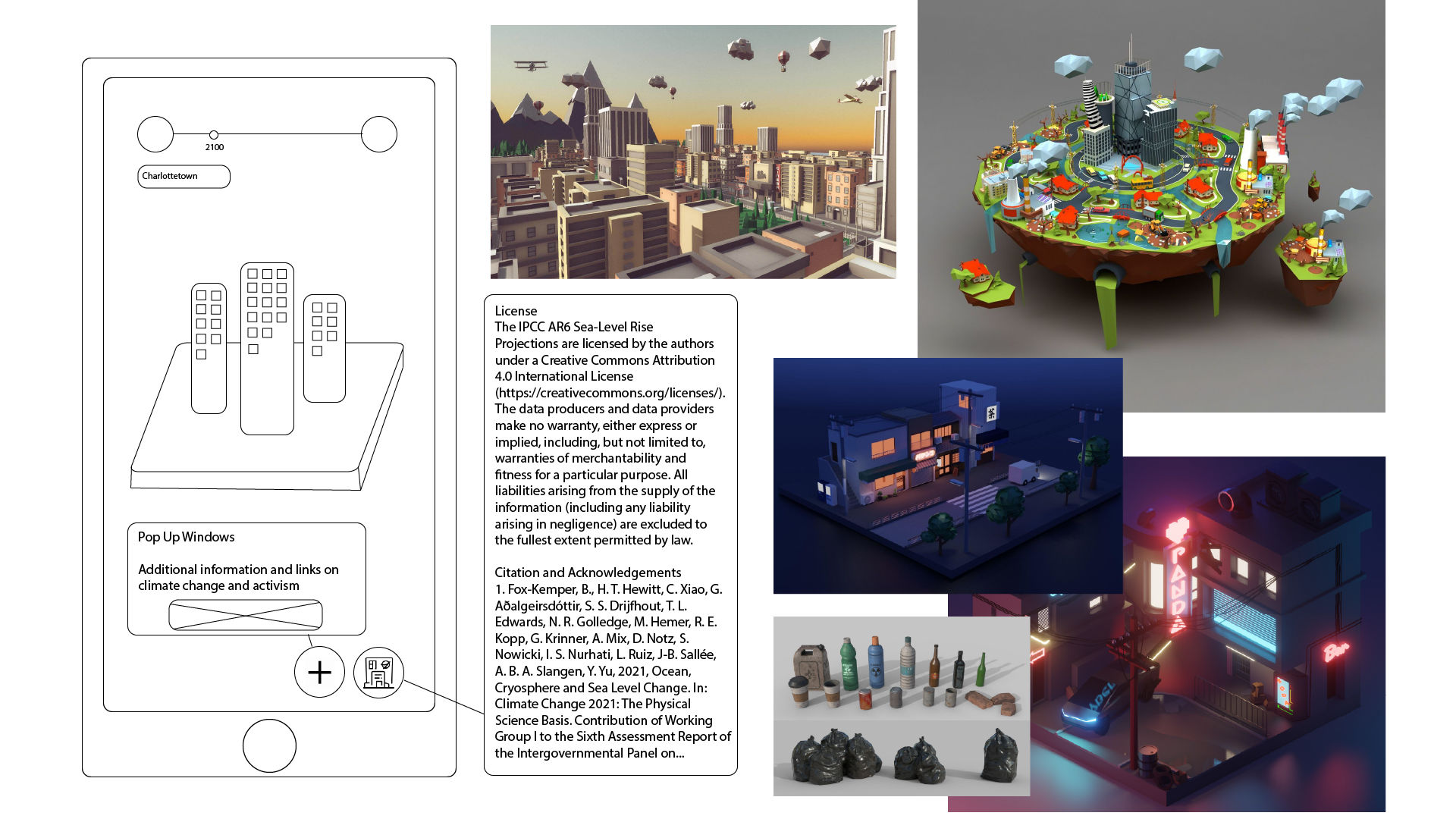
Wireframe UI design & Moodboard4
Design
With an intuitive and straightforward user interface, ARise is designed to be an easy-to-use app.
Since everyone can play around with this application, we wanted to ensure simplicity and minimalism are at its core. As a result, we decided on 3 design principles:
Easy to Use • Minimal • Informative
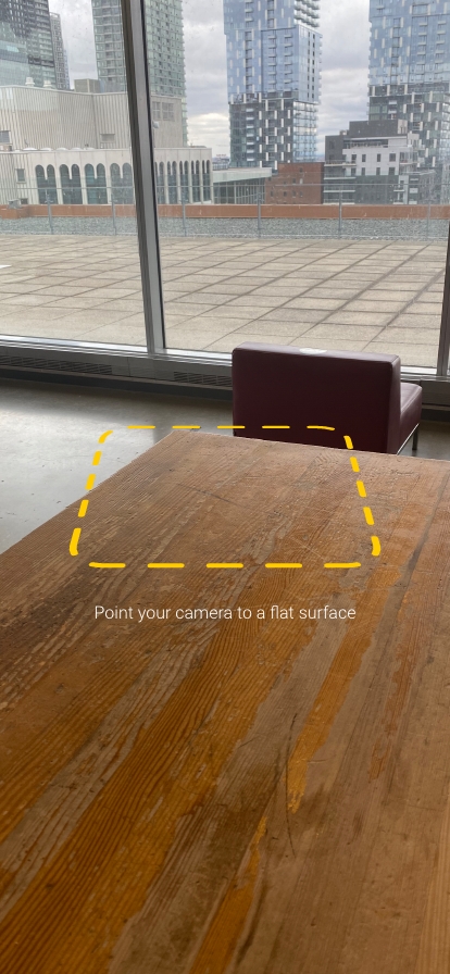
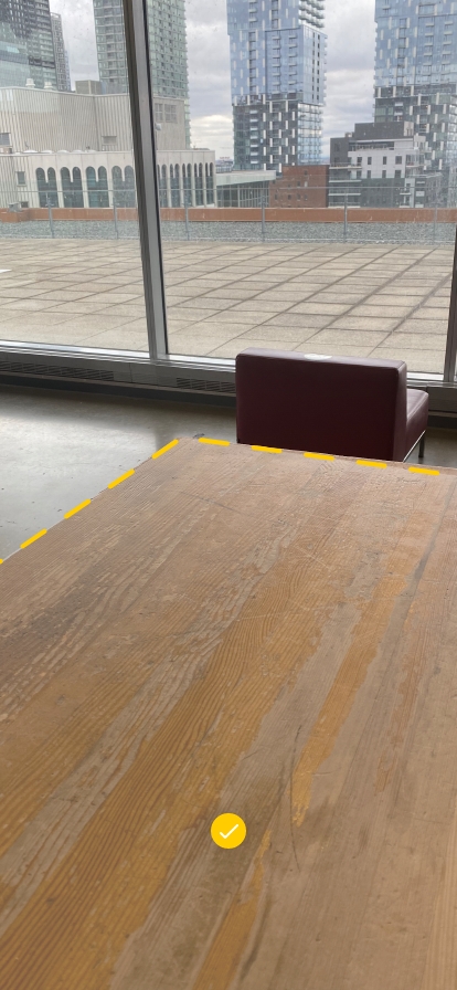
DEMO • Starting the app
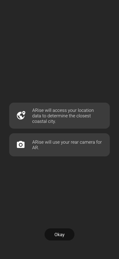
Users will be able to jump right in when their phones can detect a flat plane in AR with the rear camera.
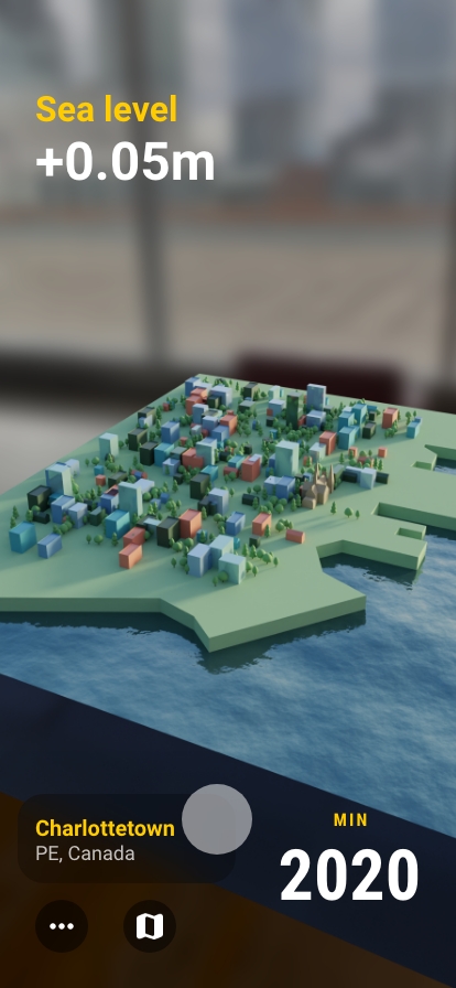
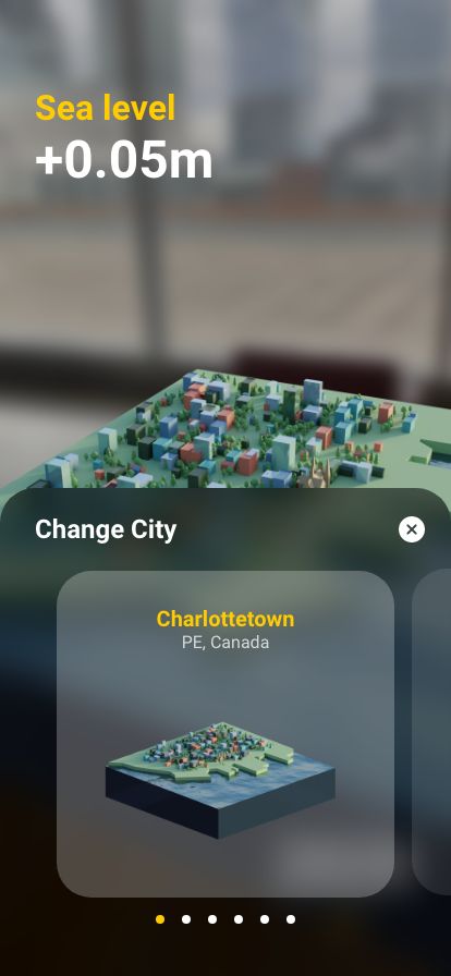
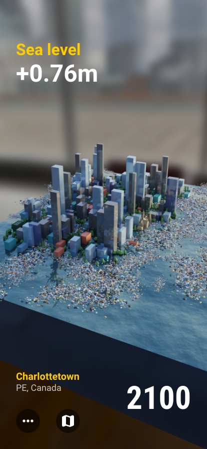
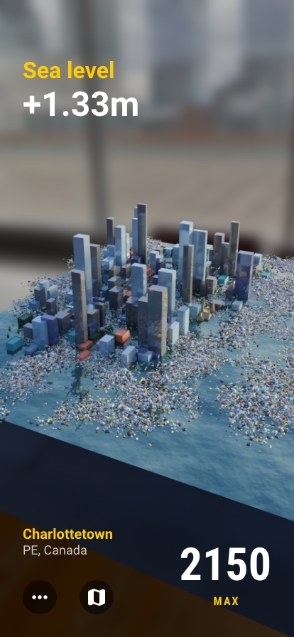
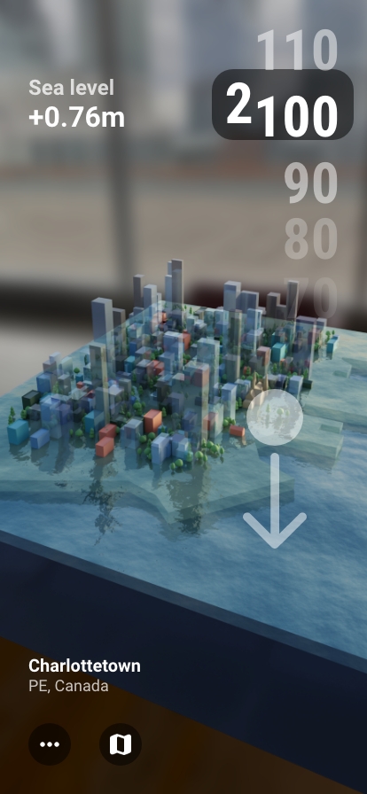
DEMO • Rendering the city
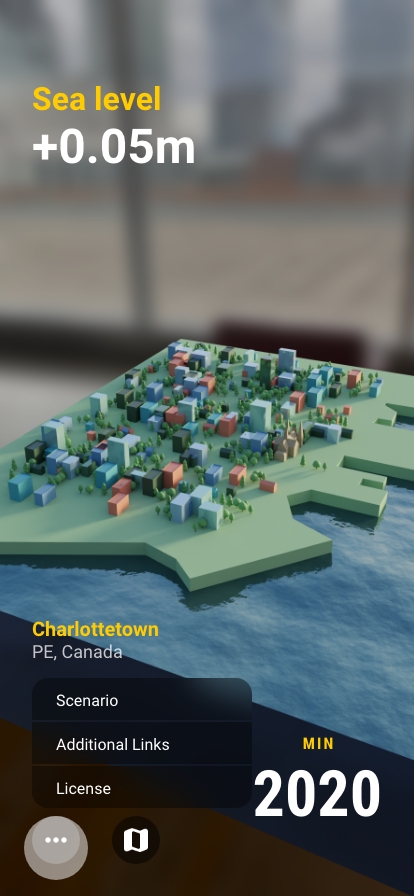
The app will communicate with the phone and determine the user's closest coastal city. A model of the city will be rendered on the plane.
Each 3D city available will have its own unique landmark. In this proof of concept, you can see Charlottetown's St-Dunstan's basilica.
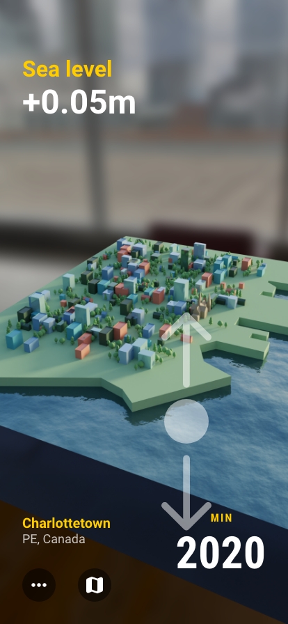
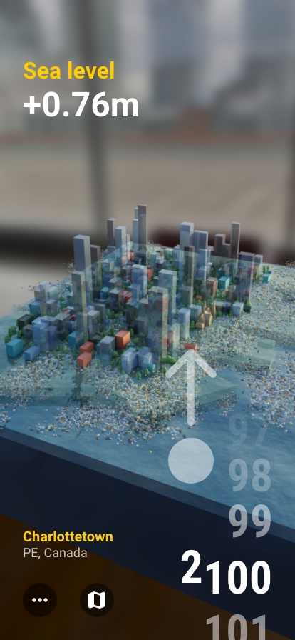
DEMO • Changing the year
To change the year, users can simply swipe up or down to go forward into the future or go backward in time.
The program automatically updates the number indicating sea level depending on the year. The model will also reflect the sea level as the water rises and floods the street and buildings.
We can also see the pollution level rising as various littered objects appear in the water.
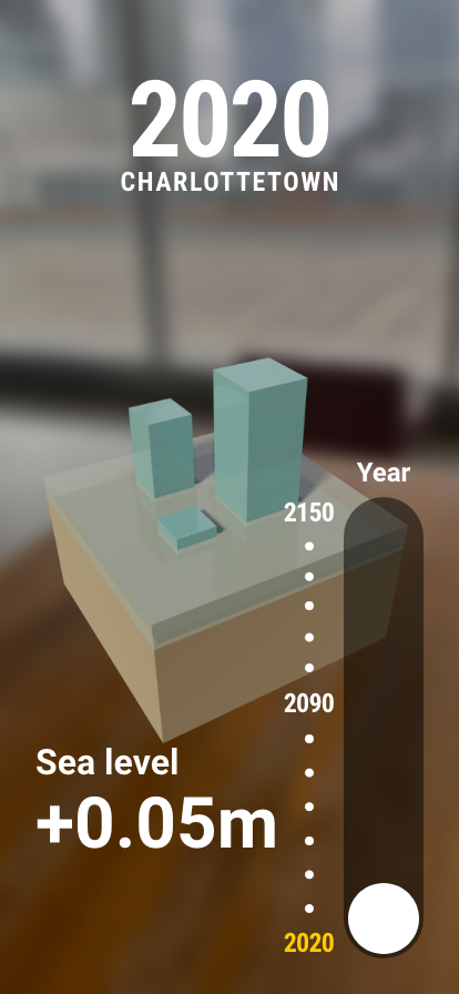
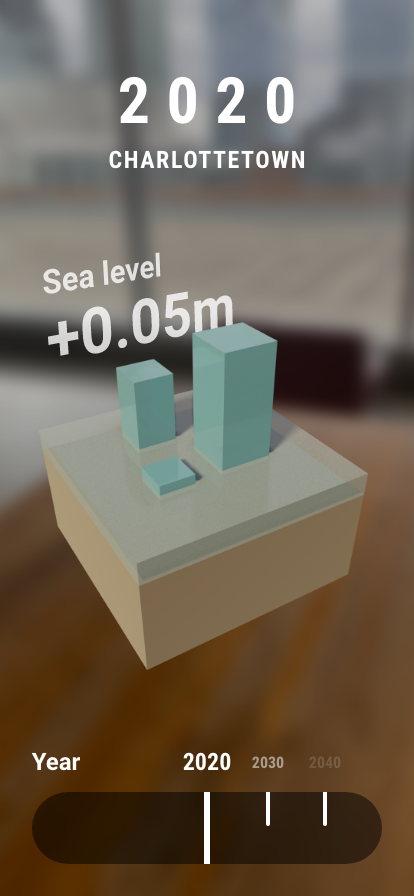
The Best Way to Manipulate Time
One of the most difficult element to design was the year slider.
The action of changing the year from 2020 to 2150 needs to be intuitive and easy. I knew it had to be done with one hand or otherwise it would not matter.
Iteration 1: Button Slider
Users need to press on the circular button in the right corner and drag it up or down to go forward or backward in time.
Evaluation: Simple and understandable but requires an extra step.
Iteration 2: Horizontal Timeline
Users need to swipe right or left at the bottom to go forward or backward in time.
Evaluation: Sensable and logical but still not intuitive for single-handed use.
Iteration 3: Number Picker
Users need to tap on the number and swipe down or up to go forward or backward in time.
Evaluation: It requires an extra step. And swiping down usually associates with decreasing quantity.
Iteration 4: Page Scrolling
Users can swipe up or down to go forward or backward in time.
Evaluation: Simple and natural. Swiping up is the most common action on smartphones, easily achievable with one hand.
UI Iterations
Each image showcases an iteration of the year slider.
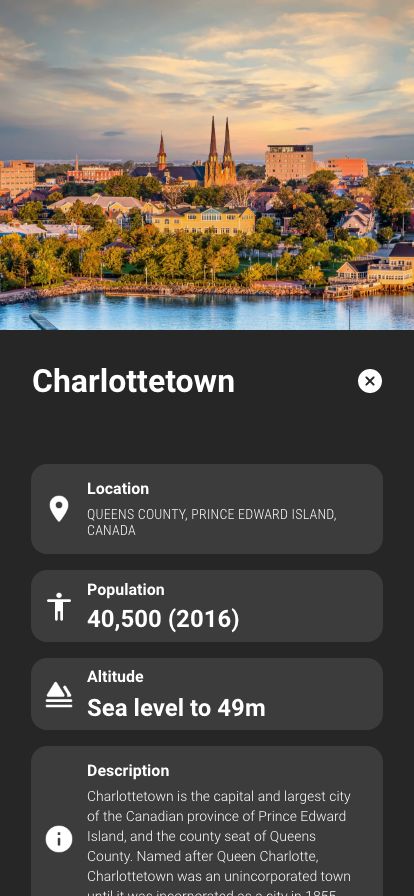
Information and Education
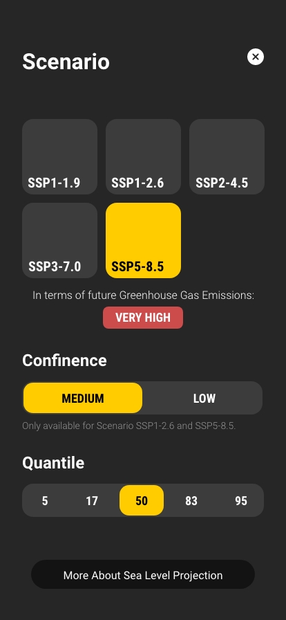
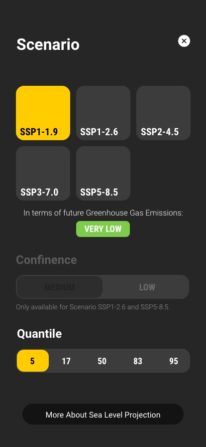
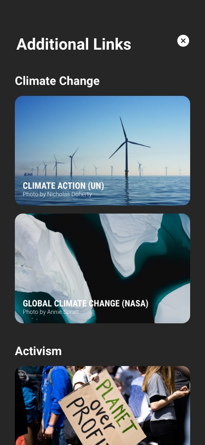
Additionally, users can dive deeper into the sea level projection by going to Scenario to change how the sea level is projected. There will also be a page where users can access links to learn more about climate change and climate activism.
License is also included in the app.
Changing scenarios and accessing other information
Result
ARise is an application that will educate the populace concerning climate change and its impact, provide an immersive and personal experience for people to witness a speculative projected future, and criticize the current power structure in an AR environment.
Though ARise is far from providing an immersive and impactful experience, our project attempted to make the climate crisis more tangible for the audience. Climate change is projected to be more impactful in the future, so ARise can be an important force to encourage people to rethink their way of living.
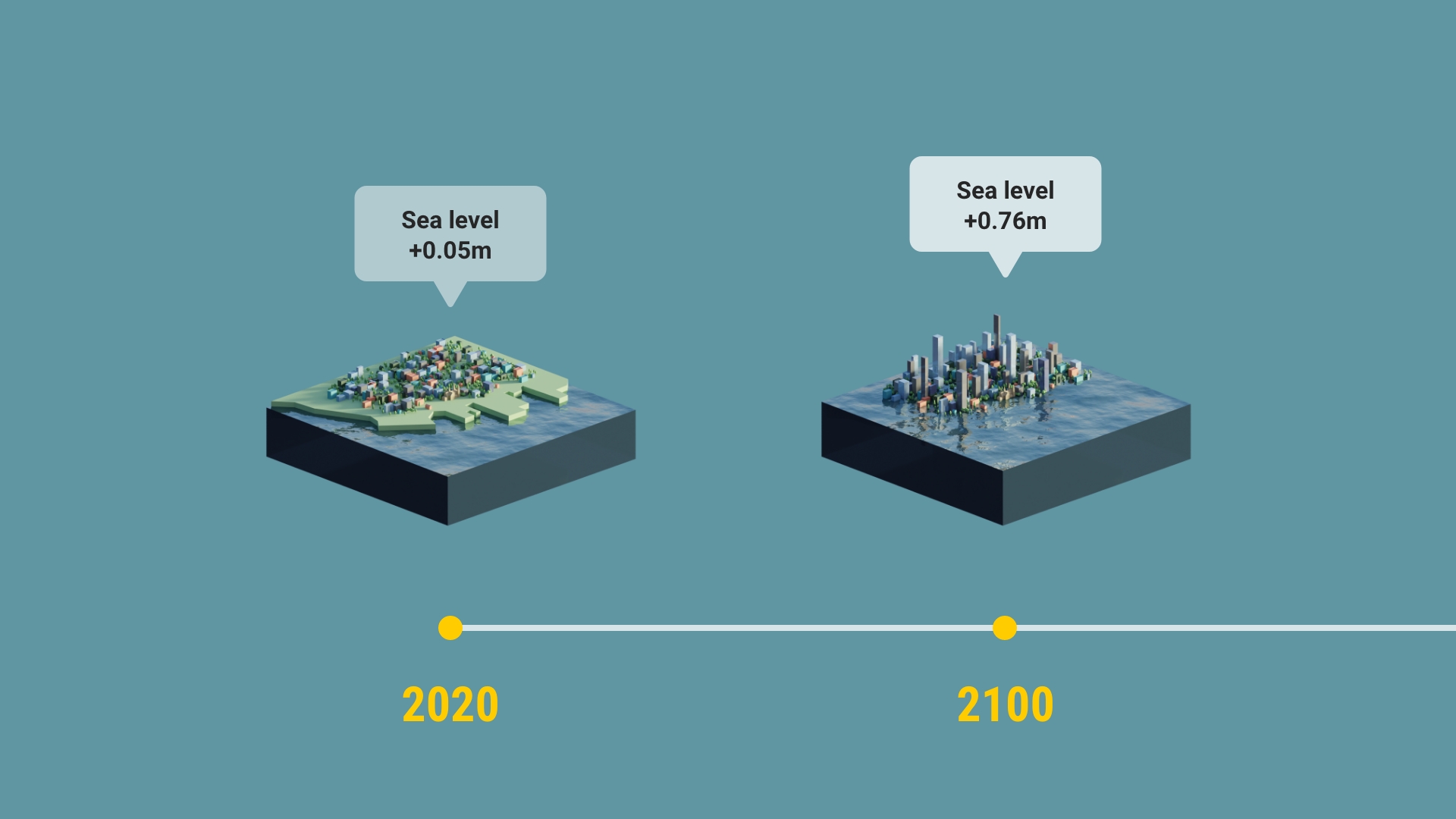
Sea Level Projection Visualization
1. The project is also known as RISE.
2. Concordia University (Montreal, Canada).
3. From Antonioli, Misty, et al. “Augmented Reality Applications in Education.” The Journal of Technology Studies, vol. 40, no. 1/2, 2014, pp. 98. JSTOR, https://www.jstor.org/stable/43604312.
4. Wireframe and moodboard were provided by Tessa Hudson.
The user interface was designed in Adobe XD. 2021 - 2022.
All data and visualization are based on NASA's Sea Level Projecion Tool at https://sealevel.nasa.gov/ipcc-ar6-sea-level-projection-tool.